Concentrated Flow Path Mapping
Over the last few decades, the scientific and conservation communities have focused a tremendous amount of attention on water quality and the health and management of the Chesapeake Bay. It is well understood that upstream land use has a substantial impact on water quality, but having a detailed understanding of how water and pollutants move across a landscape is critically important to identifying specific efforts that will help restore the health of the Bay.
Thankfully, legislation such as the creation of the EPA’s total max daily loads (TMDL) for the Chesapeake makes it clear that scientists, law makers, and citizens alike recognize the need to limit the flow of pollutants before they reach the Bay. The Chesapeake Conservancy has taken advantage of state-of-the-art technologies and datasets to aid in this effort. Using highly accurate, and publicly available LIDAR elevation data, in tandem with stream flow and accumulation algorithm tools developed by Dr. David Tarboton from Utah State University, the Conservancy has been able to map areas where water flow is concentrating with a much higher level of precision than can be found with the current National Hydrography Dataset. 
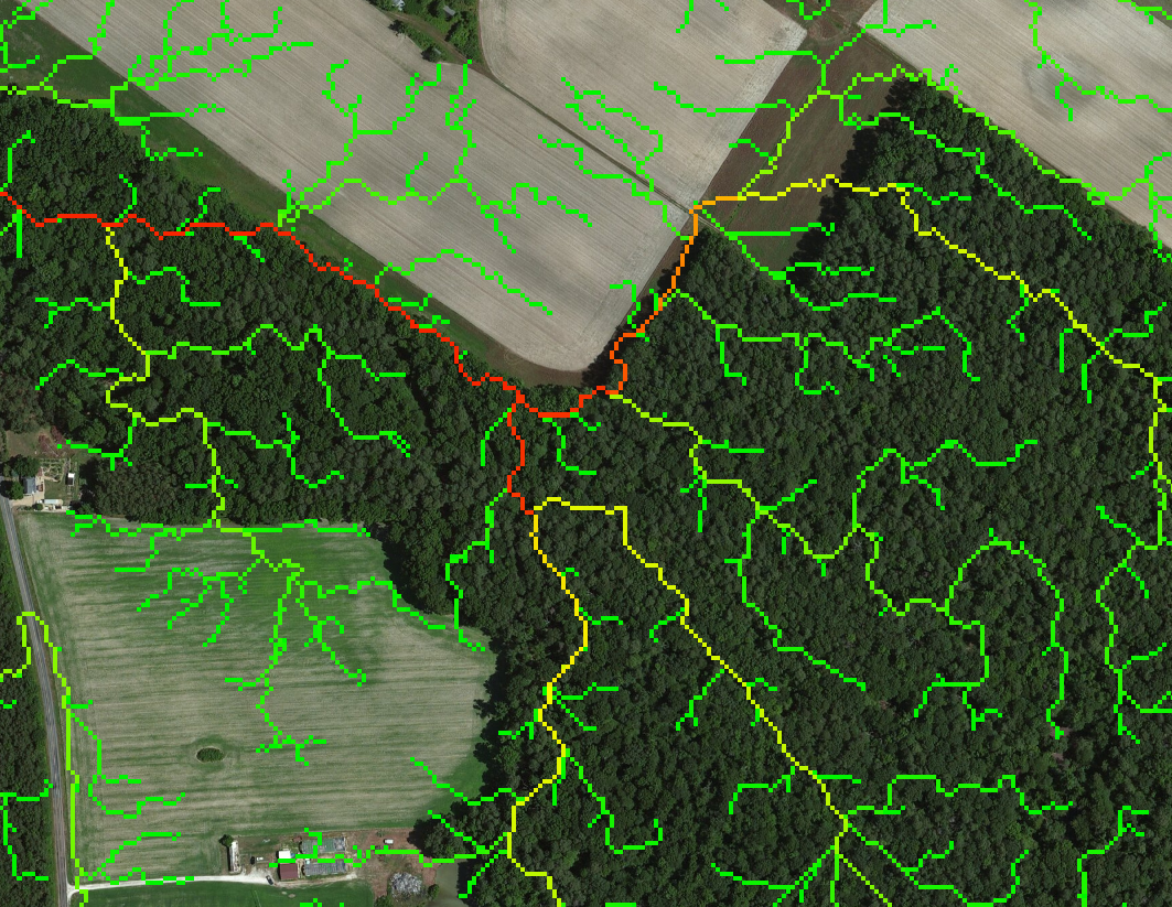
Even by closely analyzing aerial imagery by hand it is not always possible to determine how water flows off of a landscape, especially in low-relief areas such as the coastal plain of Maryland and Virgnia. Often what appears to be a level farm field will actually have a few main drainage channels responsible for the majority of the pollutants coming off of that property. The Conservancy’s new datasets better target those flow paths while also rating the channels based on total water volume accumulation. This data allows for a more efficient prioritization of funding and best management practices, targeting the areas that will create the greatest reductions in nutrient and sediment runoff. Those channels with higher accumulation will naturally be the most critical streams on which to focus best management practices such as planting cover crops, restoring streamside buffers, or creating retention ponds. The image to the right shows an example of the complex network of drainage channels flowing off of seemingly uniform fields into an adjacent forest.