Chesapeake Conservancy Demonstrates Use of Cloud-Based Computing for Conservation to an Audience of 16,000
Conservation Innovation Center team presents at Esri User Conference plenary and five individual sessions
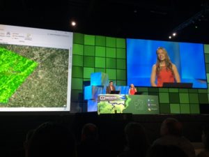
Annapolis, MD – Today, Chesapeake Conservancy presented at the 2017 Esri User Conference in San Diego, California. Chesapeake Conservancy Director of Conservation Technology Jeff Allenby and Geospatial Program Manager Cassandra Pallai spoke at the conference’s opening plenary, demonstrating the use of distributive computing—or using multiple cloud-based servers—to generate and analyze land cover data.
 Allenby and the Chesapeake Conservancy’s Conservation Innovation Center (CIC) team are using Microsoft Azure cloud technology to analyze the Chesapeake Bay watershed for the demonstration, increasing the efficiency of data creation by over 15x, and then quickly identifying changes over entire landscapes. Now, as a result, we can provide our partners an assessment of what is changing (i.e. decreased forest cover or increasing impervious surface) with an up-to-date and unprecedented level of detail and accuracy. We can provide a detailed roadmap of where conservation and restoration actions are most needed to keep on track with our watershed restoration goals. The value of Microsoft’s technology to Chesapeake’s precision conservation work has been captured in a new video, here.
The presentation demonstrated how distributive computing can increase the speed of going from imagery to action. Chesapeake Conservancy created new land cover data from 2015 aerial imagery for the conference and compared it to data generated from 2013 imagery as part of the Chesapeake Bay High-Resolution Land Cover Project. This comparison focused on impervious surfaces, such as roads and sidewalks, in Albemarle County, VA. The demonstration showed possible changes to these surfaces, which, according to Allenby, has multiple uses. This information can be used to identify conservation opportunities by organizations like Chesapeake Conservancy. Local governments can also use the data for management purposes, including assessments for stormwater utilities.
“You cannot ask for a better chance to talk about what we at the Chesapeake Conservancy are doing and how it can improve the world. What we’re demonstrating has dramatic applicability to help solve environmental challenges across the country and around the world,” Allenby said. “Chesapeake Conservancy is providing a road map for other small organizations and local governments who don’t have all of the resources of a large consulting company that have traditionally been needed to be able to do this analysis. We’re saying, ‘It doesn’t matter how small of an organization you are, you can still get this level of detail.’ It’s really exciting to be able to provide the vision and solutions for how nonprofits and other small organizations can leverage this power and technology to empower information-based management.”
Chesapeake Conservancy was honored at Esri’s User Conference in both 2015 and 2016, but this is the first year Chesapeake Conservancy was asked to present in front of their entire audience of 16,000. In addition to the plenary session, Chesapeake Conservancy will also present at five individual sessions during the conference.
In the individual sessions, four CIC team members will also give five presentations during the conference. Pallai will present in the conference’s Sustainable World Community showcase, demonstrating Chesapeake Conservancy’s uses of Esri’s tools for image classification and how other nonprofit organizations can apply this technology.
Senior Applications Manager Colin Stief will speak about converting land cover data into information about the land, such as how it is being used and how Chesapeake Conservancy’s partners have used this detailed information.
Geospatial Analyst David Saavedra will talk about the Chesapeake Conservancy’s work with the University of Maryland, Baltimore County to develop a methodology for mapping stream channels throughout the Chesapeake Bay watershed.
Geospatial Analyst Louis Keddell will give two presentations at the conference. The first talked about the mapping process for Chesapeake Conservancy’s Envision the Susquehanna initiative, which involved creating maps that used partner input to identify priority areas for conservation projects. Keddell’s other presentation will detail how Chesapeake Conservancy’s partners have used the land cover data created by the CIC, with common issues organizations experienced and information on how to improve the data in the future.
###