Chesapeake Conservancy Launches Online Boater’s Guide
Web Application Makes Guide for Nation’s First All-Water National Historic Trail Mobile Accessible
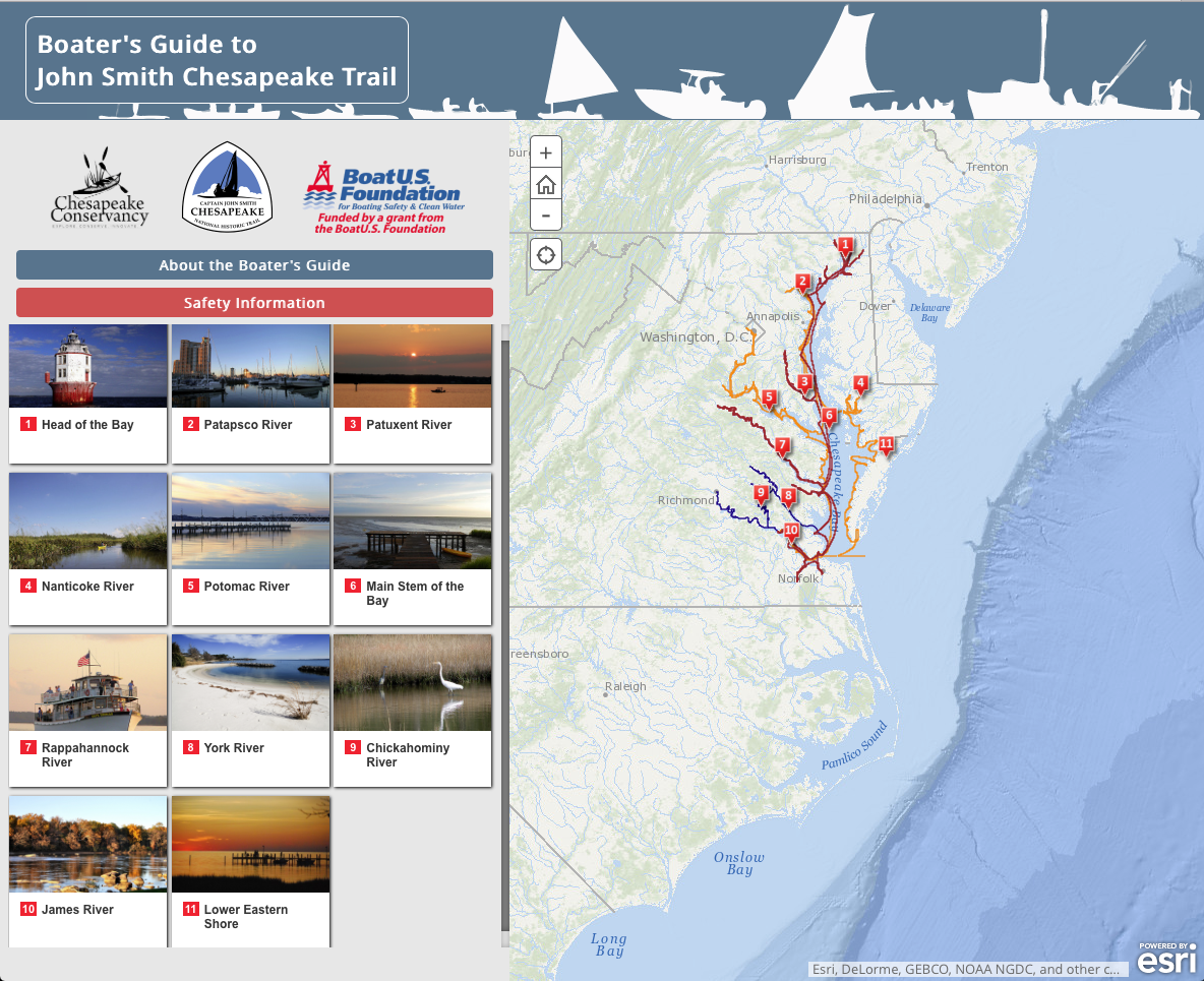
 Annapolis, MD – The Chesapeake Conservancy today announced the launch of a companion mobile application for “A Boater’s Guide to the Captain John Smith Chesapeake National Historic Trail,” (Boater’s Guide) a free publication written by John Page Williams of the Chesapeake Bay Foundation and edited by Paula Degen of the National Park Service, Chesapeake Bay office. A partner in the original Boater’s Guide, the Chesapeake Conservancy recently used storymap technology from Esri to create an interactive series of maps that allows users to plan trips along the Trail from their computer, smartphone, or tablet.
“We’re very excited to release this mobile app to explore the John Smith Chesapeake Trail, as this year marks the 10th anniversary of the Trail and the 100th anniversary of the National Park Service,” Chesapeake Conservancy President and CEO Joel Dunn said. “Thanks to the BoatUS Foundation and the public who voted for us to win and receive this grant, the Chesapeake Conservancy is using technology to connect the past with the future. The new mobile Boater’s Guide will allow people to have the most up-to-date information in planning their adventures and make the most of this national treasure.”
The app can be found at http://chesapeakeconservancy.org/apps/BoatersGuide/
Funding for the project was provided by the BoatUS Foundation. The Foundation chose the Conservancy’s proposal as a finalist with over a dozen other nonprofit organizations. These finalists then competed for funding via an online public vote.
The new mobile Boater’s Guide app allows users to click on itineraries at various locations on the map to expand the different areas of explorations and to learn more about each unique region of the Chesapeake. Each itinerary provides photos from the area and an interactive map for users to plan trips. Itineraries also include the distance a boater will travel in each stretch of the rivers and creeks, as well as background information on the waterway, including geography, history, wildlife, and the best type of craft for boating excursions.
“The original Boater’s Guide is a wonderful source of information to plan a trip along the John Smith Chesapeake Trail,” Chesapeake Conservancy Director of Conservation Technology, Jeffrey Allenby said. “We have taken that abundant information and presented some of it in a more technologically advanced format. The mobile Boater’s Guide allows users to access the information anywhere—even in a kayak in the middle of the Rappahannock River. With this digital format, the Conservancy can also expand the guide to include more detailed information. We plan to add more trip itineraries as we develop that content.”
The Chesapeake Conservancy would like to thank BoatUS Foundation which provided funding to create the mobile Boater’s Guide as well as Esri for providing storymap templates.
The Captain John Smith Chesapeake National Historic Trail is the nation’s first all-water National Historic Trail and is based on the explorer’s map and written accounts. The trail, administered by the National Park Service, connects with 16 National Wildlife Refuges, 12 National-Parks, and three other National Trails. It offers opportunities for tourism, environmental and cultural education, conservation, and recreation.