Land Use Change
The Chesapeake Conservancy uses land classification maps and aerial imagery to look at how land changes over time. By understanding how the landscape is changing, we can make informed decision about where to prioritize conservation and restoration.
See below to explore our web application built for calculating impacts to the view from George Washington’s Mount Vernon:
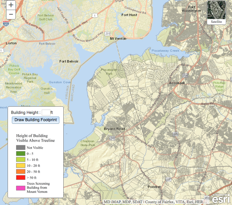
Demo the Mount Vernon Potential Development Visibility Calculator
Our Mount Vernon Potential Development Viewshed Calculator helps George Washington’s Mount Vernon evaluate impacts of proposed building within sight of their property.