Explore
Photo credit: John Wiesenfeld
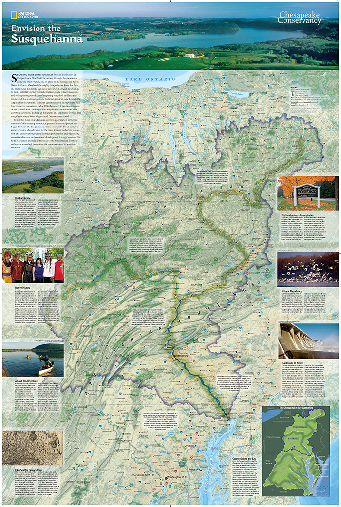
National Geographic Partnership Susquehanna River Map
To begin exploring this scenic river, we have released a detailed map, created in partnership with National Geographic Maps. The map highlights many of the special places within the river corridor. We encourage the local communities, from the headwaters in Cooperstown, NY to the end of the upper reaches of the West Branch and its connection with the Chesapeake Bay in Havre de Grace, MD to explore this special river, discover its public access points, wonder at its many creatures who call the river home, and engage in the beauty of the unique features that the watershed offers in each season.
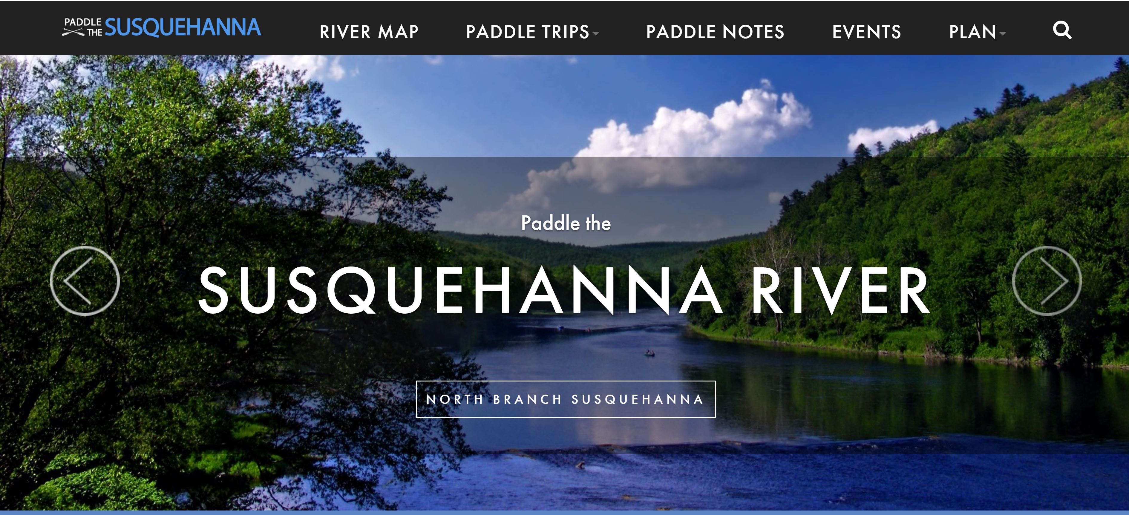
Paddle the Susquehanna
This website serves as a home for launch information, water trails, and trip itineraries for the four regions of the Susquehanna, including the North Branch, West Branch, Middle, and Lower sections. Blog content highlights specific places, activities, and personal first-hand experiences. Content will continue to be added to the site.
360 Degree Virtual Tours
Fully immerse yourself in the natural beauty of the West Branch and Main Stem of the Susquehanna River. These Google Street View style tours give you a 360 degree view from the perspective of a kayaker on the river.

