
The Conservation Innovation Center (CIC) was established in 2013 to use cutting-edge technology to empower data-driven conservation and restoration. Just as the use of technology changed the corporate world and made it more efficient, technology can do the same for the conservation movement. Through national and international partnerships, the CIC makes this data accessible for restoration professionals to practice precision conservation, yielding greater impact with fewer resources. Read about news coverage of the CIC.
PA Data Downloader
Precision Conservation
Collectively, the Precision Conservation Partnership has:
- Raised over $350,000 to restore 12 Pennsylvania farms
- Installed over 70 acres of riparian forest buffers
- Restored 2,800 feet of streams
- Installed best management practices on 180,000 square feet of barnyards
Explore the page to browse and download available high-resolution datasets.
-
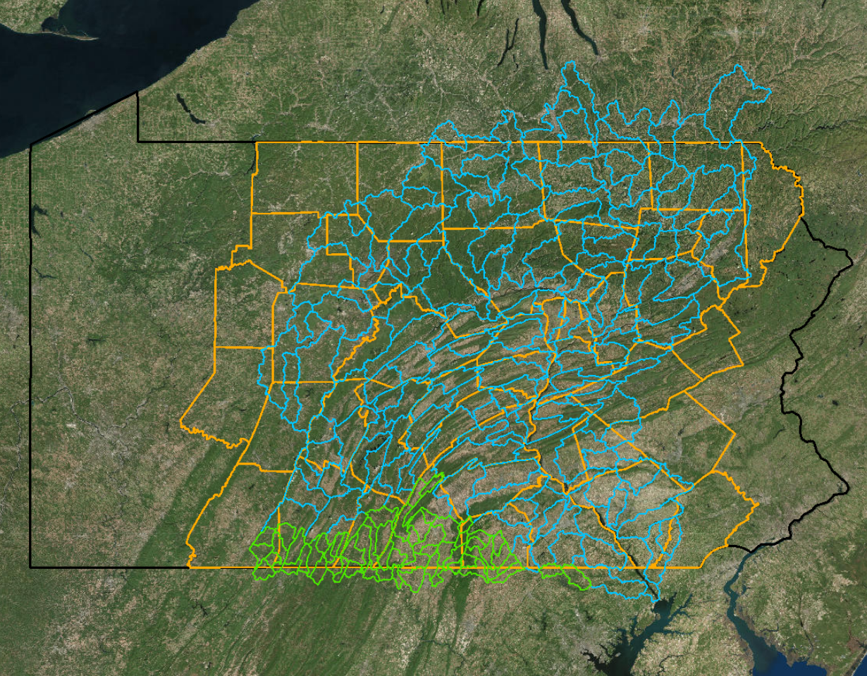
Click the map below to launch the web application. Here you can view enhanced flow paths and high-resolution buffer data, and download flow path intermediate datasets by hydrologic unit code (HUC): flow accumulation, flow direction, and hydro-conditioned digital elevation models (DEMs).
-
Scroll down to download enhanced flow paths, buffer data (35′ or 100′ buffer zones divided into 12 or 3 land cover classes), and buffer summary PDF reports available by county. Click on the desired county and click the links to download the data.
Data downloads last updated June, 2018.
Click on a county to download land cover data in the 35′ or 100′ buffer zone, or enhanced flow paths. Downloads are zipped rasters (.tif). Unzip and view in ArcGIS Desktop. Buffer summary reports for 35′ and 100′ buffer widths are available as PDFs.
Download Documentation
Land Cover Accuracy Assessment
Read about our detailed accuracy assessment methods and results for the high-resolution land cover data (incorporated in the enhanced flow path dataset) in this Chesapeake Conservancy report.
Pennsylvania Streams Accuracy Assessment
Read about our accuracy assessment methods and results for Pennsylvania stream mapping in this Chesapeake Conservancy report. This report address accuracy of flow paths prior to the incorporation of high-resolution land cover.


