The Chesapeake Conservancy supports work beyond what the National Park Service could accomplish on its own, including: improving public access, supporting land conservation, conducting cultural research and environmental analysis, and providing outreach that enrich visitors’ experiences and create a sustainable future for the Chesapeake Bay watershed.
When Congress established the Captain John Smith Chesapeake National Historic Trail, it created opportunities for federal funding and conservation efforts in this region. The trail connects with 16 national wildlife refuges, 12 national parks, and three other national trails, and it serves as a framework for large landscape conservation. Together with the National Park Service Chesapeake Bay Office and our other partners, we have protected thousands of acres of vital land, created more than 100 new public access sites, and connected millions of people with the natural beauty of our vast watershed.
Here are just a few of the many examples of accomplishments made possible along the Chesapeake Trail:
Werowocomoco
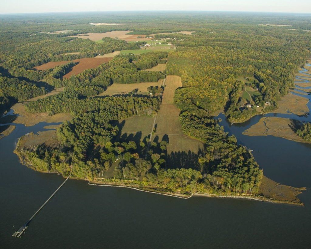
Not yet open to the public, Werowocomoco is now a part of the National Park System and the John Smith Chesapeake National Historic Trail.
In 2016, Werowocomoco, a historic site on the York River in Virginia, was permanently protected by the National Park Service as part of the Chesapeake Trail. This conservation success was made possible in large part by advocacy for the Land and Water Conservation Fund (LWCF). Werowocomoco was once the capital of a network of tribes allied under the powerful spiritual and political leader known as Powhatan. A significant place of leadership for hundreds of years, it is one of the most significant American Indian sites in eastern North America. While it is not yet open to the public pending a planning process in consultation with local American Indian tribes in Virginia, visitors will be able to appreciate its antiquity and spirituality, and gain access to its natural and cultural history.
Nanticoke River Conservation Corridor
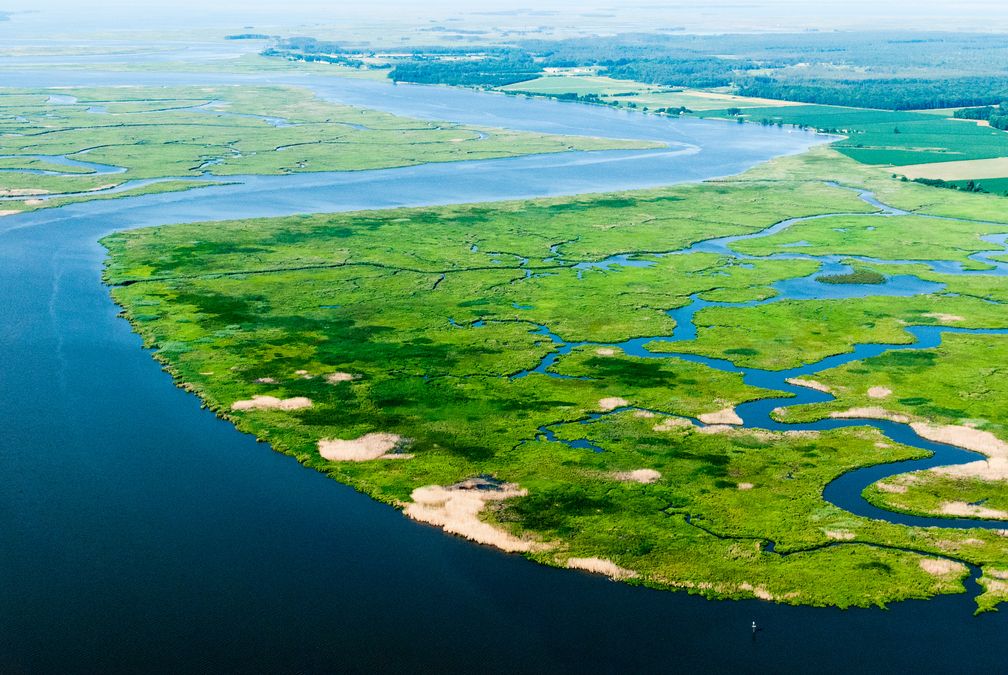
In April of 2015, the Departments of Agriculture, Defense, and the Interior designated the Nanticoke River and its surrounding areas as the Middle Chesapeake Sentinel Landscape. To date, the project has protected 9 properties totaling 1,164 acres within the Sentinel Landscapes and along the river corridor. The total cost of protecting these properties was $4.2 million and includes contributions from state, federal and private funding sources. Our partners include the State of Delaware, State of Maryland, National Park Service, U.S. Fish and Wildlife Service, US Department of Defense, Patuxent Naval Air Station, The Conservation Fund, The Nature Conservancy, Nanticoke River Watershed Conservancy, Natural Resources Conservation Service, and several private foundations, especially including Mt. Cuba Center.
Fort Monroe National Monument
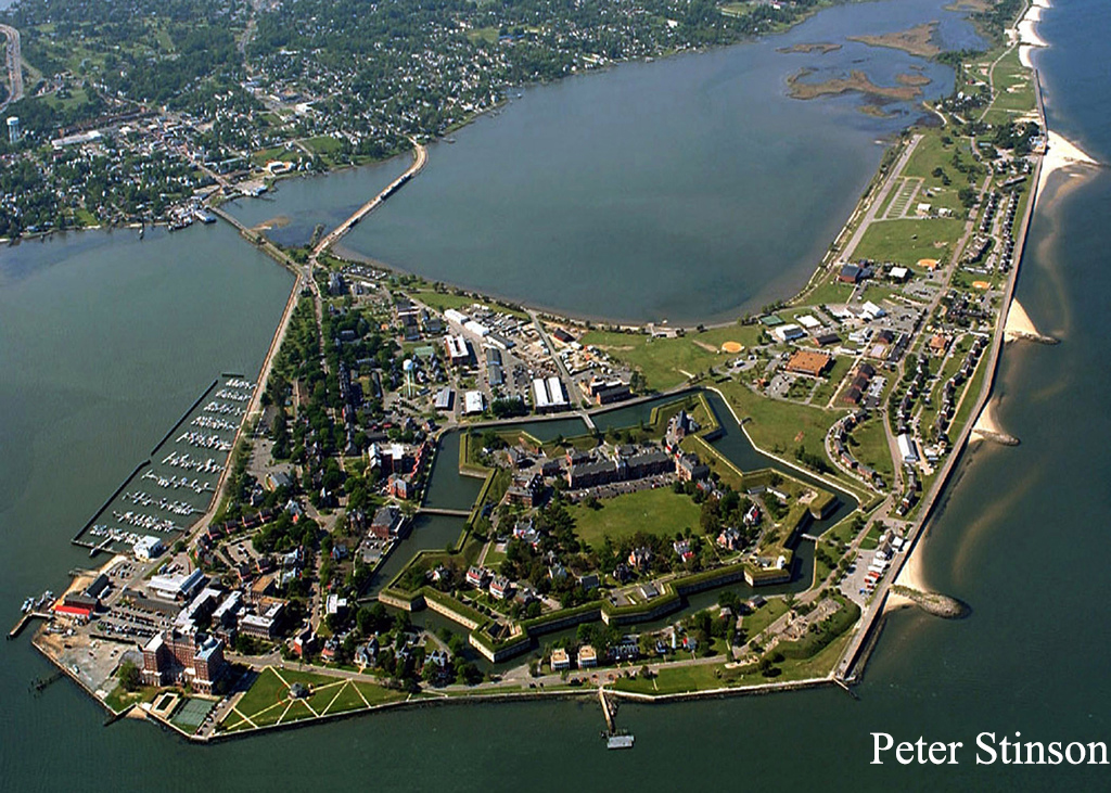
Fort Monroe, located near the mouth of the Chesapeake Bay in Hampton, VA, is a historic fort and key heritage site on the Captain John Smith Chesapeake National Historic Trail. In 2011, President Obama signed a declaration officially establishing Fort Monroe National Monument. In 2015, Virginia’s Governor Terry McAuliffe signed a deed transferring state land within Fort Monroe to the National Park Service. The Chesapeake Conservancy was a key leader in the successful formation of the Monument, took part in the Master Planning Process, and was a strong supporter and advocate for the transfer of state land. Thanks to these actions, this land is protected for future generations while providing much-needed public access to the bay and the Chesapeake Trail, and Fort Monroe‘s vast history, including that of American Indians, Blacks and our military.
Public Access
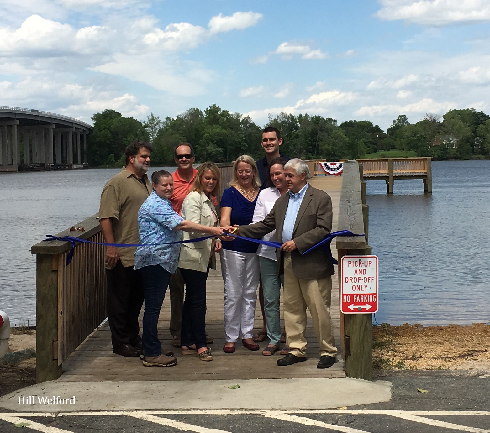
Since 2010, we’ve helped add or improve 194 new public access sites in the Chesapeake, like the recently opened Port Royal Landing fishing pier and soft launch. To be able to explore the Chesapeake, residents and visitors first need places where they can access it. With 98% of the Chesapeake’s shorelines in private ownership, the Conservancy has made it a priority to partner with the National Park Service Chesapeake Bay Office to develop and enhance public access along the John Smith Chesapeake National Historic Trail as participation in fishing, canoeing, kayaking and other recreational activities continues to grow. By working with the National Park Service and local partners to establish and improve public access facilities for the Chesapeake Trail, we are helping visitors get out on the water and view the same landscapes Captain John Smith experienced over 400 years ago. These partner efforts strive to fill in the gaps in access identified in the Chesapeake Bay Watershed Public Access Plan.
Jesuit Properties
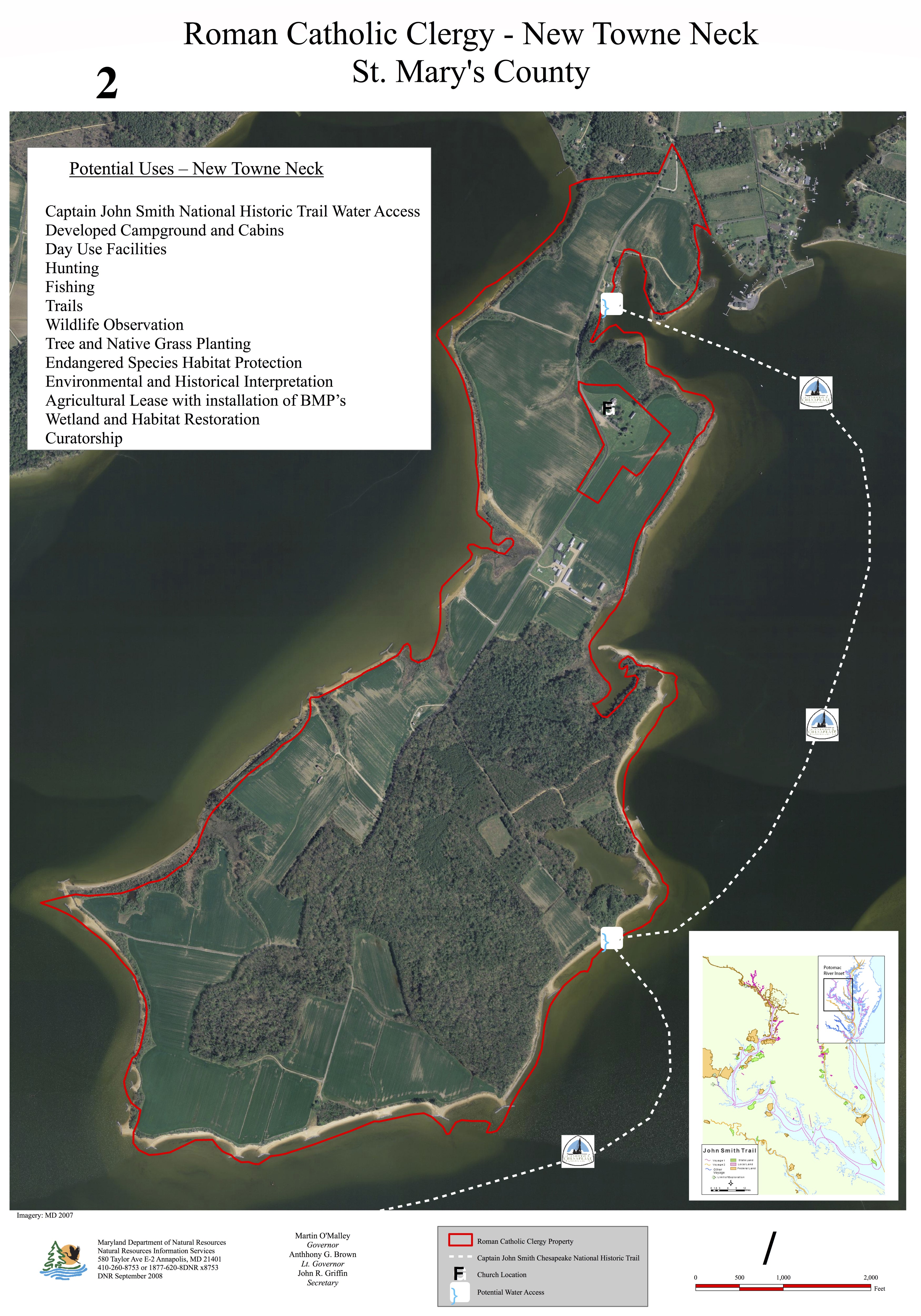
In 2009, former Maryland Governor Martin O’Malley and the Board of Public Works approved funds to preserve some of the state’s most historic lands: five parcels — located in the counties of Cecil (Old Bohemia), Charles (Cedar Point), Worcester (Foster) and St. Mary’s (New Towne Neck & St. Inigoes) — that collectively represent 4,473 acres and include nearly 20 miles of Potomac River waterfront. Owned for centuries by the Maryland Province of the Society of Jesus, popularly known as the Roman Catholic Jesuit Order, these parcels became available for sale. By approving the lands’ purchase with Program Open Space funds – a dedicated source of conservation support – the Board of Public Works ensured that generations of Marylanders will experience this outdoor legacy. Chesapeake Conservancy was a core advocate of protecting this land.


