Stormwater Management Tool
The Chesapeake Conservancy is developing web-based mapping tools to inform stormwater management through the Chesapeake Bay watershed.
We produce high-resolution elevation maps to help determine where surface water flows across the landscape. Coupled with land cover classification maps and supplementary data such as sewer and ditch locations, we can begin to prioritize places for conservation and restoration.
See below to explore our web application built for the York County Stormwater Consortium:
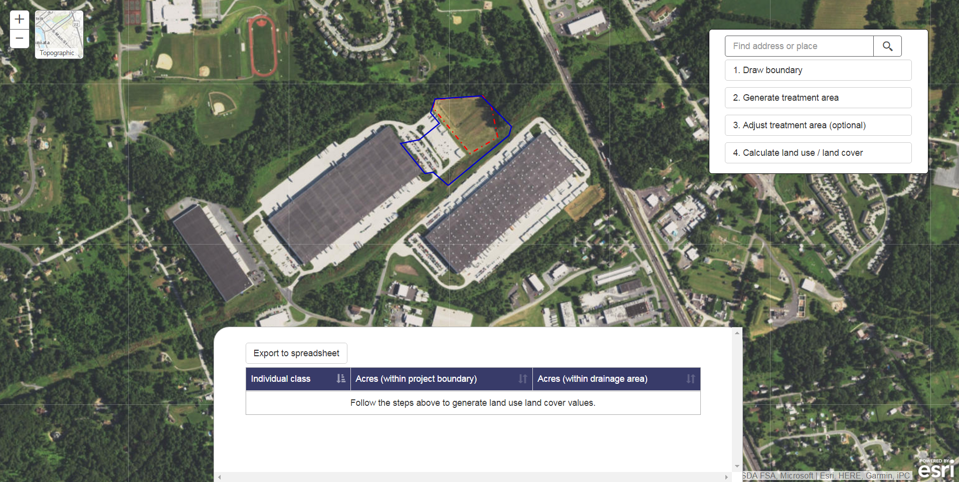
Demo our York County Drainage Area and Land Use Calculator
Our York County Drainage Area and Land Use Calculator helps the York County Stormwater Consortium collect reports on proposed stormwater projects.